[ad_1]
January 1, 2024
4 min read
Cloud-diving expeditions reveal the hidden physics of brewing snowstorms

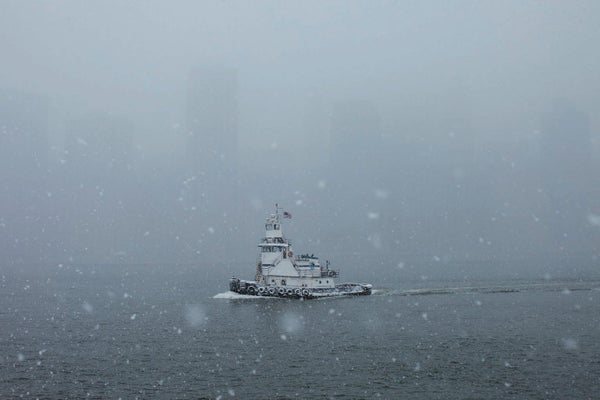
The aircraft’s windshield was a sheet of pure gray, with visibility nearly zero as the NASA P-3 rattled through a snowstorm at 15,000 feet. Probes affixed to the wings measured ice particle sizes in the clouds, infrared thermometers recorded temperatures, and cameras snapped thousands of pictures of ice crystals. As the data rolled in, more than a dozen scientists in the cabin logged the information. Eight miles overhead, a pilot flew another plane through the very top of the same cloud. The air was so thin that he wore a spacesuit.
This eight-hour mission was one of many conducted over three years for a NASA program called Investigation of Microphysics and Precipitation for Atlantic Coast-Threatening Snowstorms (IMPACTS). The project involves more than 300 atmospheric scientists, meteorologists and crew members. Data from their flights, which were completed in February 2023, are filling gaps in scientists’ knowledge of snowstorm physics—such as where in a cloud ice crystals form and the conditions under which they fall out as snow. The findings will be used to help forecasters better predict where snow will fall and how much will accumulate—a difficult task, much to the chagrin of meteorologists, skiers and schoolchildren hoping for snow days.
“We’re really trying to understand how all these different processes act together to produce the snowstorms that create the havoc,” says Robert M. Rauber, a recently retired atmospheric scientist at the University of Illinois Urbana-Champaign who serves as one of the project’s principal investigators.
On supporting science journalism
If you’re enjoying this article, consider supporting our award-winning journalism by subscribing. By purchasing a subscription you are helping to ensure the future of impactful stories about the discoveries and ideas shaping our world today.
When cold air from the poles meets warm, moist air from the tropics, it creates ice crystals that may eventually become heavy enough to fall as snowflakes. But predicting where snowstorms will hit and how much snow they will leave behind is a notoriously challenging task. That’s because the journey from ice crystal to snow squall is so complicated and meandering.
The crystals often form near the top of a cloud, then drift slowly downward. If there are any nearby updrafts in the cloud, though, the crystals may get swept back skyward—where they can combine with other ice crystals to become faster-falling snowflakes. These flakes then organize into bands, which are commonly depicted in weather forecasts as colored strips showing where the heaviest snows will likely occur. But the factors that govern how these bands form are still largely unknown. And any snow reaching the ground may still melt, depending on the warmth of the earth.
Clouds typically consist of many horizontal, cakelike layers, each with different properties. Snowstorm forecasters in the 1970s and 1980s watched for patterns and used models that drew information from just a few of those layers; today better instruments and computer modeling have allowed meteorologists to examine eight times as many. But in making predictions, more data are always better, and forecasters have to work mostly with observations from past research projects to interpret satellite observations and inform their models.
“Our forecasts have improved pretty steadily over the past few decades, but we need a lot more information on the gory details of what happens in those storms,” says Jim Steenburgh, an atmospheric scientist at the University of Utah, who was not involved in the IMPACTS project.
In 2009 Rauber’s team began looking more closely at the insides of snowstorms through a project called Profiling of Winter Storms (PLOWS). Using advanced radar technology on the ground and in planes, the scientists collected amazingly detailed data on the microphysical properties of Midwest snowstorms. It showed what Rauber calls snow plumes: areas within a cloud where convection-driven wind blows upward, even as ice crystals fall down. “That’s when we said, ‘Holy smokes, there’s a lot of stuff going on here,’” he says. These next-generation airborne radar systems “changed our whole view of these storms.”
A decade later Rauber and collaborators began making IMPACTS flights to study U.S. Atlantic coast snowstorms, which are fueled by humid ocean air. The team used even more advanced radar and lidar equipment to help reveal the presence and ratio of supercooled water and ice crystals in a cloud, using a measure called reflectivity. This allowed them to study how that ratio changes depending on variables such as temperature. Short- and medium-wavelength radar also gave views of minuscule particles, as well as the overall structure of the cloud, at high resolutions. And by flying two planes simultaneously—the first project of its kind to do so—the researchers followed how the ice crystals formed within and at the top of a storm system.
These data from the project’s 35 flights revealed the microphysical processes by which snowflakes become heavy enough to fall: aggregation and riming. In aggregation, ice crystals combine and grow into snowflakes; in riming, ice crystals pick up supercooled water droplets as they fall. The IMPACTS project provided some of the most extensive observations of snowflakes created by riming in a cloud.
“We’re trying to use the radar-reflectivity information to figure out if one or both of those processes are present in regions where it’s snowing heavily. Is it aggregation? Is it riming? What’s going on in there?” says IMPACTS lead investigator Lynn McMurdie, who works as an atmospheric scientist at the University of Washington.
With a better idea of how ice crystals become heavy enough to fall from a cloud, scientists are now using IMPACTS data to better understand what happens in the snow bands in which the crystals fall—specifically, how the bands that result in the heaviest snowfalls form. Future analyses could focus on how the structure of snow clouds changes with time and affects storm strength. Although the recent measurements focused on the U.S. Atlantic coast, the factors that contribute to devastating snowstorms could likely be applied elsewhere.
In future projects, slower-flying vehicles such as drones could capture more detailed information from various cloud layers simultaneously, revealing more about how ice crystals form and change. But for now simply identifying which physical processes are at play in a looming storm can help forecasters make better predictions, according to Brian Colle, a Stony Brook University atmospheric scientist who worked on IMPACTS. “Just being able to say that this region is going to get enhanced snowfall because of snow-band activity is a step forward from where we’ve been in the past.”
Maqvi News #Maqvi #Maqvinews #Maqvi_news #Maqvi#News #info@maqvi.com
[ad_2]
Source link


